


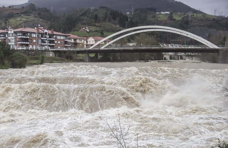
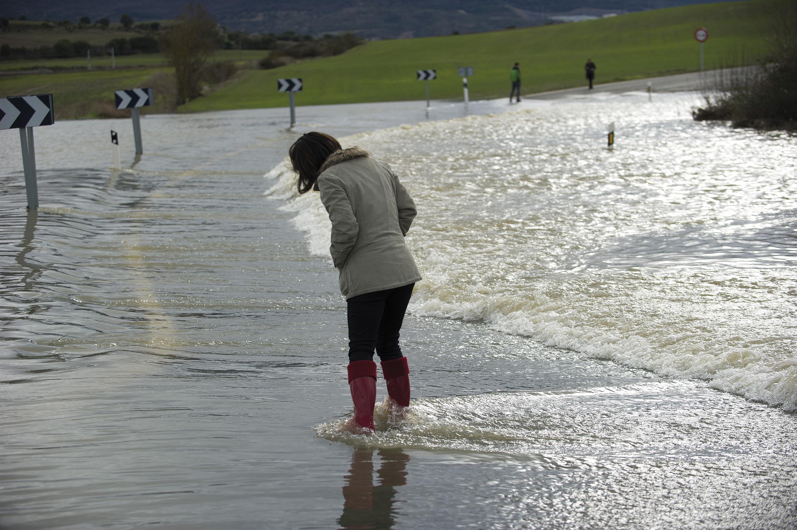
Floods: new solutions to the problem of always
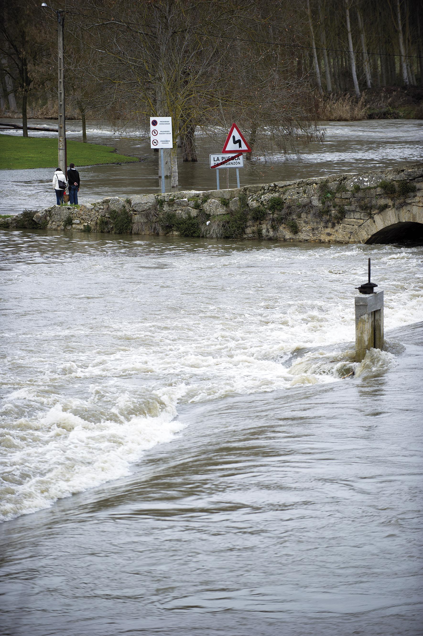
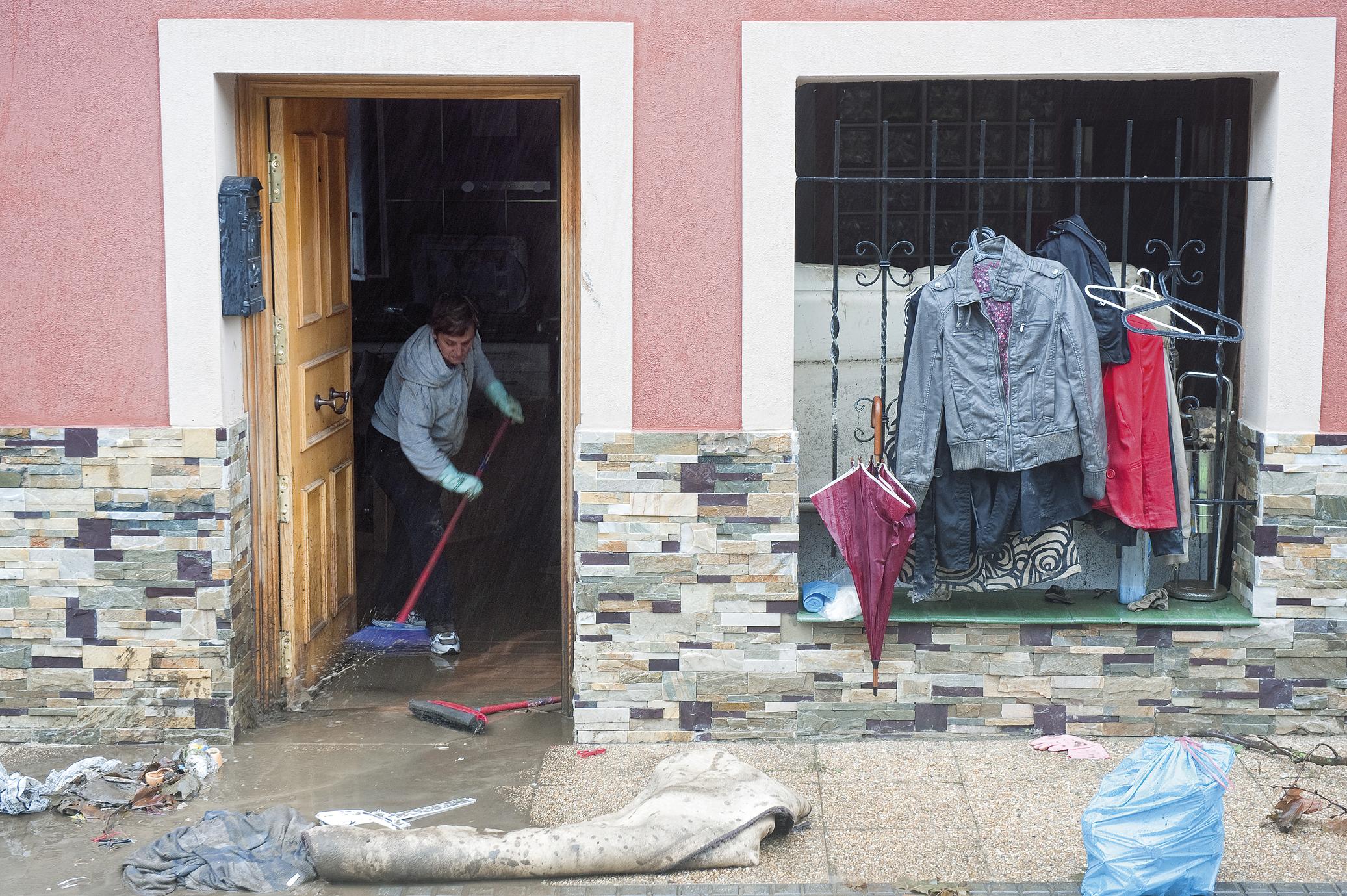
The neighbors of Txomin-enea, in the Martutene district of Donostia, have been evicted from their homes, which must be demolished to liberate the land they occupy. In this way, two objectives will be met: to avoid the repeated damage suffered by these citizens as a result of the floods and to return to the river the land they claim in each of them.
The Basque Water Agency, URA, has 30 priority projects for the realization of works that minimize the risk of flooding in already urbanized areas. These include the transfer of industrial houses and polygons. These are ambitious projects and expenditure that aim to "seek a balance between the care of the environment and the protection of people", says José María Sanz de Galdeano, director of planning and works of URA.
In fact, "for decades, even centuries, urban and industrial nuclei have been built in flooded areas, and we have received at the base a function of government of them. Now, on the other hand, we try to get out of the water and not damage the margins of the rivers", explains the head of URA.
However, they find it impossible to always play in this way, “sometimes we just have to do a hard job. Most of the interventions that are being carried out in the Gobela River, for example in Getxo, go this way, we are creating a parallel channel for it to be fulfilled in the time of the great waters. Now, however, we are going to enter the last phase, in the street Errekagane, in the center of the town, where we can only increase the walls, that is, attack a little more the river", says Sanz de Galdeano.
The measures that are now considered exceptional, until recently were habitual actions when it comes to taking measures to deal with the floods: to channel the flow of the rivers through walls, to channel it, to dredge it and to "clean" the rivers, that is, to eliminate the vegetation and other elements of the habitat. "River managers have had little imagination for years," said Sanz de Galdeano. For example, in terms of pipelines, in the CAPV the river network has 2,028 linear kilometers, of which 10% are channeled (according to data from the Basque Government of 2005).
These measures are the ones that "demand every time the rivers rise, from the mayors to the farmers or any of the streets. But they are as wrong as the generals." This is explained by Alfredo Ollero, professor of physical geography of the University of Zaragoza, in an opinion article published at the end of January in the blog Taking Care of Rivers. "The media also provide a unique vision of the victims and scientific arguments they rarely give," he says.
More beneficial than harmful
The objective of traditional interventions is to increase the section of the riverbed and the straightening of rivers to allow the passage of a greater volume of water without overflows. "Rivers are considered fluvial channels by those who demand them, as well as their enemies," explains Oller. Sanz de Galdeano, as he plans the work to be done in the rivers, knows these requirements first hand and considers that "the neighbors do not have to know what is most convenient. They live in flooding areas and see their homes, their workplaces, and their families in danger too often. Well, what the observed and senses in the floods does not conform to what suits the environment".
However, experts are aware that these are not, in general, effective measures in the management of floods. "These works provoke great changes that cause the risk to diminish. But many times they are to the detriment of those who request it," explains Dr. Joserra Diez in ecology.

As in the case of the wall of the area of Errekagane in Getxo, when the rivers are channeled or channeled in an area, it is in this area where you can deal with the problem of floods, since with the walls the height of the bed increases. However, Diez has emphasized that below this tramitado section can be greater the effect of the great waters, "due to the higher speed of water in the channeled section. In addition, if the river is compressed between the walls, the pressure on the subsoil is greater, which causes outcrops of water in areas far from the bed".
Another problem associated with the walls of protection against the floods of the rivers is that their safety is limited. Thus says Sanz de Galdeano: "People believe that this is not a danger, and so it is, while the walls are able to maintain the flood. But if the water rises to exceed that level, the damage caused will be much greater." Among other things, due to the existence of walls, the water that leaves outside cannot return to the river and the flooded area remains stagnant for longer.
On the other hand, dredgings and cleans cause a much greater impact on the ecosystem than the advantage it gets with them, and their side effects can also be serious. In addition, experts agree that no problem is solved with them: "they serve for little; they only have placebo effect," says Diez. Oller explains that "growing materials accumulate in previously cleaned areas. So cleaning the rivers is throwing money in vain."
In specific cases and moments, however, it is considered acceptable to carry out this type of cleanliness, such as "when material has been piled up by some bridge, or in some area of narrowing of rivers, or when there is some obstacle", said Sanz de Galdeano. To carry out this type of specific cleaning, last year the departure for the whole of the CAPV was 3 million euros.
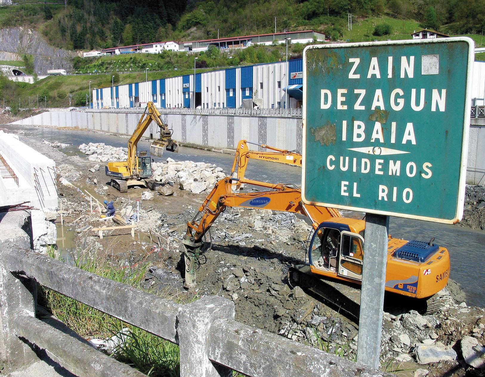
However, when dredging and integral cleaning are carried out, the waste of the river is not eliminated, but sediments, living vegetation and trunks, "that is to say, the biodiversity of the river is directly and indirectly destroyed, the lecturers are eliminated... the rivers are greatly damaged", he stressed.
In addition to the biodiversity condition, the fluvial zones and infrastructures associated with them can be affected by dredging, as Diez has specified: "When the sediment and trunks are removed, the water erodes the river bottom, which has consequences such as the decrease in the water table and the destabilization of the bottom. In addition, bridges can be destabilized if the water, by means of a bed, leaves in the air the shovels of the bridges, since when they were dimensioned it was not taken into account that the erosion of the river was similar. The same can happen with the sheds created to sustain the margins of the rivers, for the same reason".
Noxious river infrastructures
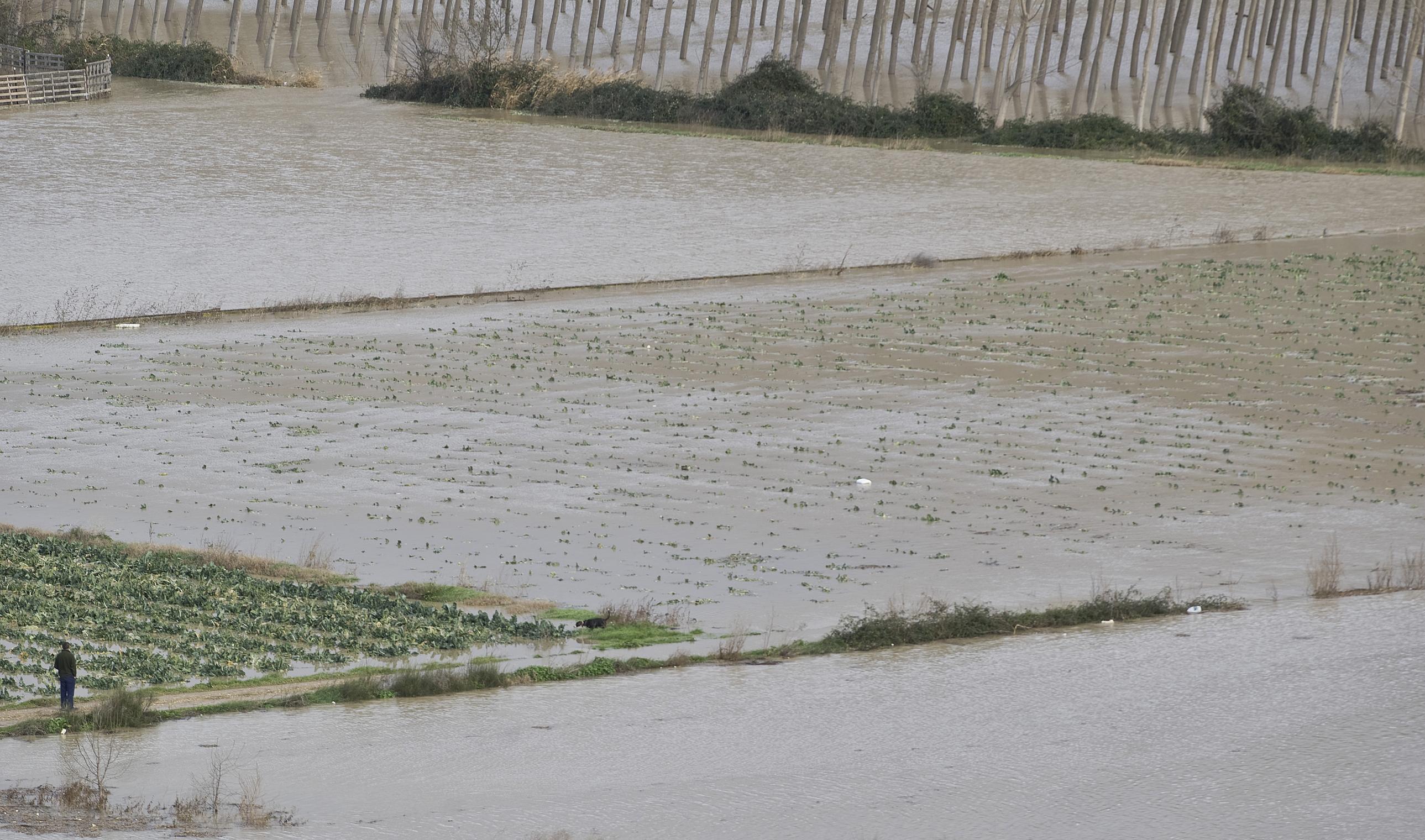
The infrastructures that are generated in the environment of the fluvial channels generate on many occasions an increase of the risk of flooding. For example, when areas close to rivers are found to create roads, car parks or other infrastructures, all of them are waterproof. As a consequence, the rain that you see in it comes much faster to the rivers.
Bridges also have a lot to see as torrents. In fact, there have been times when there has been a change in the structure of a certain bridge, with the consequent disappearance of the floods that occurred in the area. This was seen by the Diez team in the restoration project of the Nervión river in the area of Mercabilbao: "In the hydraulic study we clearly saw that a bridge located 500 m below increased the flood that was produced in this area."
The change of structure of the bridges necessarily implies a modification of it, so, as Sanz de Galdeano has remembered, sometimes "we cannot do it because the bridges are totally protected by their patrimonial value. On many occasions it has happened to us to propose the modification of a bridge and therefore we have refused". Then, "we have to re-influence the mind to protect people, the environment, and in that case also heritage."
The two sides of the reservoirs
Other infrastructures of great importance in the management of the floods are the reservoirs. For their capacity of water uptake, they are elements of large number of vertices. Its positive effect is that they stop the higher levels of the floods, thus avoiding increases in lower areas of the reservoirs. Consider exemplary the management carried out by Sanz de Galdeano in the rains of January in the river Zadorra: "The river flow was 300 m3/s and the water retained in the reservoirs only allowed 50 m3/s to be poured from the dam. The management was really excellent."
This management has, however, a risk. In Zadorra itself there were important damages in 2003 due to the inadequate management of the reservoirs. "At that time the level of all rivers in the area was very high and it was expected more than enough to begin the release of water, since the rules had established it (the priority was to collect water). Because the damage was very great, when they began to be released because many waters had to be released at the same time," said Sanz de Galdeano.
This fact of 2003 made known to the managers of the reservoirs and the administrations involved. "Today we have defined it with precision and according to criteria other than those of that time, at what time we must begin to release water and with what flow. And yet, when there are worrying weather predictions, we don't follow those curves and before we start to drain," explains the URA manager.
Regarding the water retention capacity of the reservoirs, Sanz de Galdeano warns that there is also another side of the coin: "Due to the construction of a reservoir there are areas that often stop remaining under water. Well, if the occupation of these areas is authorized, and at some point there is a very important flood, if the reservoir is not able to maintain this water, the damage that can be caused can be very serious. That is, a false sense of security is created that in serious cases can cause a disaster."
Changes in the territorial organization
As the example of Zadorra shows, river managers are changing their activity. There are many factors that have driven it, among which are the knowledge acquired from previous experiences, the incorporation of technicians who perceived the environment from another point of view, and the entry into force of water regulations such as the European Water Framework Directive. "I don't think the behaviors have changed from black to white compared to those that were done 10-15 years ago, but they are changing. And society in general is more concerned about the environment," says Sanz de Galdeano.
Another indicator of this change is the planning of the territory. Sanz de Galdeano of the Agency URA speaks: "Since we began to give more space to the river, we have seen the need to remove the built in some places, hence the 30 priority projects planned. In addition, the Hydrological Plan to approve (for the internal basins of the ACBC) is very demanding in this regard. According to him, it will not be possible to build in high flood areas (called preferred flow areas). And the construction will not be authorized, even if this is the only possibility of extension in a given municipality. In this house, at least, we have it very clear. Of course, it's not always easy, because city councils have a lot to say and there may be lack of coordination, but much progress has also been made."
For the ecologist Joserra Diez, progress has also been made in the area of land management: "A few years ago, in many of the projects, the floor level was raised by fillings and sheaths to be able to build in preferential flow zones and adjacent lands. In this way, the floor is at a higher level than that which would be officially flooded in floods, so it has not suffered construction problems. I think many polygons are built on the banks of the rivers."
Among the reasons that justify the change in recent years, Sanz de Galdeano has added to the aforementioned a new one: "The crisis is helping a lot. I know the plans abandoned by the crisis to build houses of official protection on flood zones, for example."
However, the crisis has not paralyzed all plans and there are still projects to build on unnecessary sites. Ten has brought another significant example of a few months ago: "In July 2012 the Superior Court of Justice of the Basque Country considered the construction plan of 480 dwellings in Aiegui, Ondarroa illegal. In fact, this plan involved the development of a large area of the Artibai estuary, with the consequent thinning of the protection area and the loss of natural capacity of wetlands to alleviate the effects of floods. This shows us that we still have much to learn."
In this sense, he added that in small municipalities there are the most violent interventions and works, “because they have less technical advice and, in short, they are the ones who have the competence to say what use is given to the soil. There the problem begins".
In fact, Sanz de Galdeano considers that the first step to be taken to ensure that flood management is effective is the non-occupation of the areas not yet occupied: "If we do not allow ourselves to worsen the situation, we will have to invest less in the recovery of the environment and in the protection of people since they will be in safe zones. That is, we have to look beyond the short-term and learn to live with floods. Because in the environment in which we live, we are always inundated."
Buletina
Bidali zure helbide elektronikoa eta jaso asteroko buletina zure sarrera-ontzian


