RAMSES: technology to prevent invasion of desert otia
When traveling alone they do not cause danger, but as a team they are able to destroy everything they catch from one moment to another. They increase appetite, cause imbalances and damage of high cost. The only weapon against which one can fight is the location of the hiding place and the counterattack, although many times they manage to survive. Today, authorities are using the most advanced technology to locate perpetrators. The RAMSES system seems gradually the enemy is being dominated. It is the Otis, the Otis of the desert.
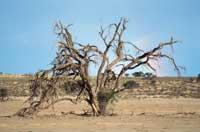
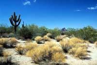
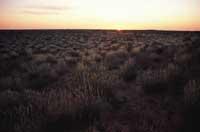
Someone thinks they are the desert bandits who walk with the turban on their heads. Well, no. They are insects similar to grasshoppers found mainly in the desert or near the desert: North Africa, Sahel (Burkina Faso, Chad, Mali, Mauritania and Nigeria), Arab Peninsula (Saudi Arabia, Yemen, Oma, etc.) and west of India. When they work alone, the lobster population is low and does not generate risks. However, after the dry season, the vegetation of the otis breeding areas grows rapidly, which considerably increases their population. Lobsters then gather in groups and seek food.
At first it was considered that there were desert otis (Schistocerca gregaria). Now they know that otis of the same species can have different colors and behaviors. For example, lone lobsters are brown in themselves, but by joining a group they become pink and in old age that. For the formation of mists, when coming into contact with the surrounding otis stimulate the sensors of the rear legs, thus synchronizing the behavior of all of them. A fog can reach an extension of 20 x 50 kilometers and can exceed 300 adult lobsters per square meter.
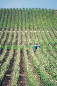
The greatest manifestations of otis took place between 1986 and 1989. So in East Africa more than $275 million was used to fight insects. However, the locusts did not carbonize and destroyed 5% of the harvest. Lobsters eat a lot and fast: a small portion of the lobster mist (about a ton) is able to eat the same amount of food an elephant or 2,500 diners can eat one day. When attacked just before harvest, the effects can be very serious. When the 1987 plague ended, the insects managed to reach 25 countries and very serious losses occurred.
Since then there has been some apparition, but no other. However, experts know that it can appear from one moment to another. Therefore, it is important to use the most efficient and advanced methods of detection of lobsters possible in order to take further action. This is what the FAO Migratory Pest Group (Food and Agriculture Organization of the United Nations) has been developing for two or three years.
FAO was founded in 1945. It is an intergovernmental organization made up of 180 countries. The main objective is to improve the level of food, the quality of life and the production of rural territories and, in general, to improve the situation of its inhabitants. All this is done through different departments. Among them is the Migratory Pest Group, which is responsible for helping combat TIS pests. Driven by this group, a new lobster detection system was started in 1998. It was called RAMSES (Reconnaisance And Monitoring System of the Environment of Schistocerca gregaria) and its main supports are the GPS (Global Positioning System) and the laptop.
Cutting-edge technology
To date, the teams responsible for monitoring otis received all the information manually. They then filled out the forms and sent them by fax or email to their country offices. Finally, this information was sent to the FAO headquarters and, depending on the information received, the steps to follow were detailed. But lobsters move very fast, and when the location information went all the way they moved elsewhere. However, the RAMSES system allows you to know the current location. Because GPS satellites send information constantly. The new system is already being used in 18 countries.
This method, logically, will considerably reduce the work of specialists who explore the area. To date, they had to conduct more than twelve visits to analyze the situation, look for lobsters and dialogue and report with nomads, baserritarras and farmers in the area. On the other hand, it can be a way to reduce the use of pesticides since the origin of pests will be determined more accurately.
In addition, through the RAMSES system, FAO specialists are theoretically able to alert countries in the plague area. However, in many cases these are wars and riots between countries and countries, and it is impossible to exchange information.
But it is not enough to find the “otis”. If we do not want to reproduce and eat crops, we must find some way to kill insects and avoid pests. In general, pesticides are the most appropriate solution. The expenses generated in this task are borne by the Ministry of Agriculture and have the collaboration of the regional entities. When the plagues appear they receive international help.
However, pesticides used can pose a risk to humans. The most commonly used insecticides are organophosphates like malathion, fenitrothion, etc. All of them are toxic and harm the human being. However, with a little care and good use of the products it seems that there is no danger of poisoning.
The environmental impact of pesticides must also be taken into account. In fact, the insecticides used in the killing of locusts affect in many cases the rest of the animals, both directly and damaging the vegetation of the environment in which they live.
Satellites and computers for otis detection
To
determine the possible location of otis, researchers use GPS (Global Positioning System) and laptops. They collect satellite images and analyze data based on vegetation and the state of the atmosphere.
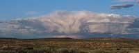
First, the thermal characteristics of Kumulonimbo tubes are analyzed, which have a high probability of precipitation in cold areas. In short, if the temperature of the clouds is low for ten days, it can be said that there is a high probability of precipitation. Therefore, images of ten days are used.
Data from the National Agency for Oceanography and Atmosphere (NOAA) of the United States, i.e. the number of standardized vegetation (NDVI), are used to obtain vegetation data. In this case the image is also adapted with data of ten days.
From these two images the possible locations of the lobster are determined. But this method has some error. On the one hand, the problem of reflection. As the desert sand has a lot of quartzite, it reflects a lot of the infrared light emitted by the satellites, as if it were an area of great vegetation. Therefore, the number of vegetation calculated is often higher than the real. Currently, RAMSES system managers are looking for a methodology to solve this problem in calculations.
On the other hand, there is an insect identification problem, since otis are not the only insects that destroy crops. But this problem is not so serious. In fact, each insect species uses a specific technique to feed itself, so its footprint in the vegetation is very significant. According to this footprint, in satellite images the color is reflected at different levels.
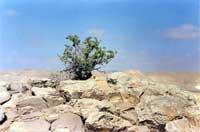
But satellite images are not enough. Next, groups equipped with GPS receivers analyze the area and look for signals. Among other things, they study the right conditions for insect reproduction. On the one hand, the sandy and humid soils without vegetation to lay eggs and on the other hand, the green vegetation to feed the young. In addition, they are able to detect the changes that otis suffer.
All this data is collected using the GIS (Geographic Information System) system to obtain as accurate maps as possible. On laptops, observers use MapInfo software developed by Mapping Information System. In addition, more powerful software is used in laboratories to perform more sophisticated GIS studies.
Published in the supplement Natura de Gara
Buletina
Bidali zure helbide elektronikoa eta jaso asteroko buletina zure sarrera-ontzian