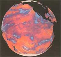
Seas are natural thermal agents

The Sun does not strike all places on Earth equally. As the rays of the sun arrive vertically at the equator and the tropics, they reach the poles transversely. Therefore, the energy received is different in some places and in others. Therefore, the equator and tropics are warm and the poles cold. Heat normally extends from low latitudes to the poles and the cold makes the reverse way. When the cool air of the poles is in mid-latitudes with the hot air of the tropics, a temperate climate occurs.
But the winds are not the only heat and cold conveyors. They are seas as important as the winds. Therefore, the main agents of climate are air and water movements.
Weather services know air movements very well, but the same does not happen with sea currents. Sea currents are known only superficially.
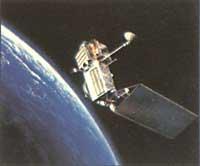
However, international researchers are willing to address this issue and have launched a gigantic research program on it. This program has a duration of ten years and aims to obtain a computer model of the traffics of all the terrestrial seas.
There are two main marine currents: the bottom and the surface currents.

The water cooled at the poles is high density, so it progressively moves to the seabed. The biggest sinking occurs in the South Pole, especially in the Ross and Weddel seas. The waters that sink in these two seas extend to most of the ocean bottoms. In the North Pole there is a similar phenomenon. The cold water sinks, but since it is not as cold as the sunken in the South Pole, it remains on the waters there.
Therefore, on the seabed there are mainly two currents: the one that goes from the North Pole to the South Pole and the one that goes from the South Pole to the North Pole. These waters are very oxygenated and have a lot of food.
Surface traffic is much faster than background traffic. The winds directly affect this traffic, but also the rotation of the Earth. Due to the rotation of the Earth, water rotates in the northern hemisphere clockwise and in the southern hemisphere counterclockwise. The movement of water between the tropics is parallel to the equator. Sea currents are much more stable than wind currents. The inertia of large amounts of water makes changes very difficult. This occurs mainly in mid-latitudes, with greater variations around the equator. In general, we can say that in mid-latitudes cold water and hot water meet each other and that the currents and turbulence thus generated are very stable.
In tropical regions the change of direction of water currents is more normal and weather effects are observed. The monsoon that appears in the Indian Ocean and the phenomenon known as “El Niño” that appears in the sea adjacent to Peru are the main examples. According to meteorologists, when changes in the circulation of tropical oceans have occurred, global weather has been directly affected by these changes. During the years 1982-1983 changes in marine currents occur. At that time, while in the east of the US there was a mild time, in the west there were floods and drought in the north. There were floods in Peru and Ecuador and drought in Africa.

Specialists say that weather forecasts (so far) cannot be made more than 10 days, since the models currently used are atmospheric models. The introduction of marine currents in the model implies the expansion of the forecast periods. Therefore, in addition to the months, forecasts can also be made for years, and you will be able to know if you are going to make a warm or rainy summer and a hard or soft winter. But there is still much to be done, because in addition to knowing the marine currents, it is necessary to establish their relations with weather and meteorology.
The earth's climate is not stable. Frost and periods of time until freezing have so far been unforeseen. Recent studies show changes in the marine currents of different eras. During frost ice descends from latitude. Norway's cold marine waters, currently under the warm waters of the North Atlantic, emerge and descend in latitude. Consequently, the surface of the North Atlantic gets colder and the European temperature drops.
On the other hand, increasing the concentration of carbon gas can cause an increase in temperature. But also in this case, the analysis is based on the atmospheric model and there are no signs of alteration of marine currents.
Influence of Earth and Wind Rotation on Water Currents

According to the laws of mechanics, the rotation of the Earth creates a supplementary force over every moving body, the force of Coriolis. This force diverts water movements to the right in the northern hemisphere and to the left in the south. This can be demonstrated by anyone in your home sink when the water is emptied into a whirlpool. While in the northern hemisphere the swirl is clockwise, in the southern hemisphere it is the opposite.
It is difficult to measure the influence of winds on water currents. In this field Eckman's theory is followed. According to this theory, the maximum speed of water movement is on the surface of the sea and the direction of the current deviates 45º (to the right in the northern hemisphere) from the direction of the wind. The further down the sea surface, the speed of the water stream is decreasing and the direction deviates more and more (to the right in the northern hemisphere and to the left in the southern hemisphere).
Buletina
Bidali zure helbide elektronikoa eta jaso asteroko buletina zure sarrera-ontzian


