[Gorrondatxe: history exposed]
At the beginning of the year, we had the opportunity to see the beach of Gorrondache in Getxo in all the means of communication. In fact, the International Union of Geological Sciences gave its rocks a special designation. The Lutetian period was designated as the most suitable place in the world for research on geology.
In the rocks of the cliff there is evidence of 48 thousand years ago. The fossils that can be found there provide a lot of information about the Lutetian geological period. We will tell you the story that can be read in these micro, macro and nanofosiles.
I'm talking about Getxo. The beach of Gorrondatxe-Azkorri. From these rocks we have a history of almost 48 million years looking at us. As if it were a book, on the rocks of this beach you can read a whole chapter of the history of the Earth, countless events in the creation and evolution of the Earth.
On the slope of the Gorrondache is the “Golden Nail”, a symbol awarded by the International Union of Geological Sciences, an organization that declared it a world reference of the Lutheran geological status.
According to this denomination, the stratotype of Gorrondache is the most important witness of the Lutetian geological state in the world, that is, it is the stratotype that best explains the geological history of Lutetian.
The earth is 4.6 billion years old. The history of his life is divided into ages, ages into periods, and periods into stages. The stratotypes are the boundaries between the estates, and the Lutetian boundary is in Gorrondache.
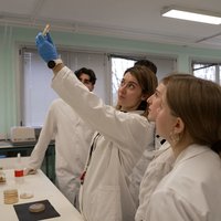
ESTIBALIZ APELLANIZ (UPV/EHU): Usually, in the case of these rocks, taking into account all these fields (stratigraphic, micropaleontological, paleomagnetic field), due to a debate among all the experts, they decide which is the geological section that can be considered as a reference worldwide.
This model has been in a different place until now, which is why it takes the Lutheran name, because it was named near Paris; but it was named at the end of the 19th century, using the tools of research methodology used at that time. Today we know it better, and we all agree that this section is better than what was decided in Paris because it offers more to do geological studies and, in fact, to know the history that the materials of this age (approximately 47-48 million years) preserve; this is the best place among those we know so far. That's why it's called a stratotype.
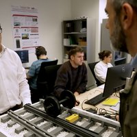
research on Gorrondache began in 1977. The cliff of Getxo allows the investigation of a history of about three million years. Geologists studied macrofossils, microfossils, and nano-fossils that can be seen with special microscopes. Among the results, two new fossil species were discovered.
It is rich in microfossil yolk. Millions can be found in its rocks, as well as traces of activities.
AITOR PAYROS (UPV/EHU): These marks that you see here are the marks that living beings left when walking on the bottom of the sea, like those that worms leave on the ground.
These here, those others, those little ones
There are a lot of these. They are not fossils; they are not the remains of living beings, but the vestiges of their activity.
Continuing with the reading of the rocks, you can go back in time and get to know the environment of the time.
AITOR PAYROS (UPV/EHU): Among the conclusions we have drawn in these rocks of the Gorrondache, the most obvious one is that when these rocks were formed, this region was under the sea, at a depth of about 1000-1500 meters. At this depth the conditions are usually calm, the water does not move, so the clay sediments were deposited. Mixed with this clay are the remains of beings that fell from the surface of the water, which we now see transformed into fossils. By studying these fossils and making a paleo-ecological interpretation of them, we can also know that this sea was of temperate water in general; we also know that, looking at other rocks that appear interspersed with this clay, there were occasional currents of greater energy reaching this seabed, and that these currents also accumulated sediments brought from the continent in this sea.
From the formation of these rocks to the present day, the geography of the region has changed a lot, and how this change happened can also be read in the rocks that are in sight.
48 million years ago, the Iberian Peninsula was like an island near Europe, and the clash between the two lands revealed the land on the seabed between the two.
AITOR PAYROS (UPV/EHU): When these materials that we have in Gorrondache were deposited under the sea, there was this sea between the Iberian island and Europe. It would be the seabed between these two dry areas. But the Iberian island gradually moved to the north until it collided with Europe. And in this collision, all the materials accumulated at the bottom of the sea between these two dry areas collapsed and rose up. And as a result of this uprising, we now see the materials accumulated under the sea under the air. They rose from being under the sea at depths of 1000-1500 meters up to about 1000 meters, to being visible today above sea level.
Thanks to the geological value of the cliff at Gorrondatxe Beach, it has now acquired the position of the Paris area worldwide.
Buletina
Bidali zure helbide elektronikoa eta jaso asteroko buletina zure sarrera-ontzian