Biodiversity conservation areas
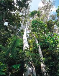
The number of endangered species is much higher than that provided by conservation resources and the situation is rapidly worsening. This requires setting priorities. That is, how to keep as many species as possible for every dollar invested? This is the question that researchers handle in the mind and will be the core of the article. This approach can be limited to areas of greatest gravity and difficult conservation and contribute systematically to the challenge of large-scale extinctions.
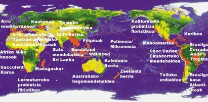
The appropriate route for this is the identification of “hot zones”, that is, areas that have a high concentration of endemic species and that are suffering an extraordinary loss of habitat. Instead of talking about populations or other taxa, we will refer to species, which is the easiest and fastest way to measure biodiversity. This does not mean that populations and ecological processes are not an important indicator of biodiversity. There are other ways to fix hot areas, but this time they have defined them as discussed above. Finally, 25 biodiversity hotspots have been declared. The accumulation of many conservation forces in these areas would allow us to deal with the massive extinction of species that is occurring at this time.
Hot areas have been fixed taking into account "biological similarities". Each area has a biota or community of differentiated species, forming a biogeographic unit. This is evident in islands and island groups such as New Caledonia, New Zealand, Caribbean, Polynesia/Micronesia, Madagascar and the Philippines. Something similar occurs in the most prominent "ecological islands" of the continents, such as the Cape Floristic Province, the Eastern Arc and the coastal forests of Tanzania/Kenya (hereinafter, we will call "Eastern Arc" grouping both), the Australian Southwest and the Caucasus. The definition of hot areas elsewhere is a consequence of the well-known divisions, such as the Sundaland and Wallacea "Wallace" lines or the Indo-Burma and Sundaland "Kangar-Pattani" lines. But there is another criterion for setting hot zones: research experts.
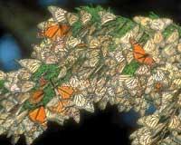
Larger hot areas, such as the Tropical Andes, Mesoamerica, Indo-Burma and Sundaland, if distributed in smaller hot areas, should follow the criterion of biological similarity. However, the result would be an increase in small hot areas, which would significantly hinder their correct assessment and would move away from the basic strategy of the 25 hot areas established as priorities for their conservation. The basic analysis for fixing hot areas used two criteria: the number of endemic species present in the areas and the degree of risk of loss of them. For species information we have had about 100 experts and about 800 bibliographic data.
As for species, they have been based on vascular plants, which account for 90% of plant species (hereinafter referred to as "plants"), which are ultimately essential for practically all animal species and are well known scientifically. The zones must contain between 0.5% and 1,500 endemic plants of the 300,000 existing plants in the world to be recognized as hot zones. In fact, of the 25 hot areas, 15 have at least 2,500 endemic plants and another 10 at least 5,000. The study also refers to the number of vertebrates in the areas, but it is not considered as criteria for the designation of hot areas (although for comparisons). Nor have invertebrates been taken into account.
The second criterion, the degree of deterioration of the zones, has been attributed once the condition of "vegetation" has been fulfilled. Thus, hot areas must have lost 70% of the original vegetation. Eleven zones present 90% of the lost vegetation and another three 95%. There are more areas that meet the requirement of endemism, but it would be necessary to lower 60% of the original vegetation to include one or more areas on the list. For example, the Amazon, New Guinea or the Congo basin have been left out of the list, as they still have about 75% of their vegetation.
Finally, the study has been limited to land areas, although the report on the sea is being prepared.
General results
Therefore, in the hot areas there are 133,149 plants that represent 44% of the known plant species endemic to the Earth. However, the endemic vertebrate species are 9,645 (35% of the total known). Meanwhile, the area occupied by the areas is 2.1 million km2, 1.4% of the dry land. Originally, these areas had an area of 17.4 million km2, representing 17.4% of the dry land. Despite the extreme reduction in surface area (which has lost 88% of the original vegetation), their level of risk remains so severe that if conservation efforts do not proliferate, even most of the remaining surface, if not almost everything, can be lost in the short term.
Main areas
Some areas are richer than others in terms of their endemism. Each of the five zones (Ande tropical, Sundaland, Madagascar, the Brazilian Atlantic Forest and the Caribbean) houses 2% of the Earth's plant and vertebrate species. Altogether, 20% of plants and 16% of vertebrates, as well as 45% of endemic plants and vertebrates present in hot areas, which only represent 0.4% of dry land. There are also the most degraded habitats: The Caribbean represents only 11.3% of the original vegetation, Madagascar 9.9%, Sundaland 7.8% and the Brazilian Atlantic 7.5%.
These five, together with the following four (Mesoamerica, Mediterranean Basin, Indo-Burma and the Philippines) represent 30.1% and 25.0% of the endemic species of plants and vertebrates, respectively, despite 0.7% of dry land.
In some hot areas the degree of concentration of endemic species is striking. In the eastern arc, for example (Table 2), there are 1,500 endemic plants in 2,000 km2, that is, 75 species per 100 km2 (expressed as 75:1). However, endemic vertebrates are 121, with a 6.1:1 ratio. Likewise, in New Caledonia (5,200 km2) there are relationships between 49:1 and 1.6:1 and in the Philippines (9,023 km2) 64,7:1 and 5,7:1. The rest have a relationship between 33.3:1 and 1.2:1 in plants and between 2.9:1 and 0.03:1 in vertebrates.
Hot zone Endemic plants Endemic vertebratesCaribbean Atlantic Forests
of Brazil Choc/Darien/Oeste de Ecuador
Cerrado de Brasil Centro de Chile Provincia florística de California Arco Oriental de Madagascar y bosques costeros de Tanzania/Kenia Bosques de África occidental Provincia florística del Cabo Sur de Chasquía Nueva
Región de
Chaco
0,3
0,3
0,3
Consistency between species groups
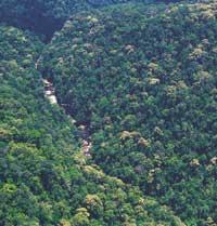
In some hot areas there is a congruence between groups of species, as in areas with abundant endemic vegetation there is abundant presence of endemic vertebrates. This reinforces the conservation priority of these areas, especially areas with the highest number of endemic species. However, in places with the lowest number of species there can be a great congruence, as is the case of the Eastern arc, with a congruence of 80%, with 0.5% of endemic plant species and 0.4% of endemic vertebrate species.
In the Tropical Andes there are 6.7% of endemic plants in the world and 5.7% of endemic vertebrates, with a congruence of 85%. Madagascar has values of 3.2% and 2.8% and 88% congruence, while in the Caribbean the percentages of endemic species are 2.3% and 2.9% respectively and the congruence of 79%. The first of these is the largest area and therefore the congruence is greater; in the other two, although the endemic percentages are more similar, the surface is around a fifth of the previous surface, so the congruence is less.
On the contrary, in the floristic province of Cabo the congruence is 11% and in the Mediterranean basin 21%. Therefore, there is a generalized decrease in congruence as they move from tropical to Mediterranean or drier areas, in which the number of endemic vertebrates decreases considerably.
Warmer hot areas
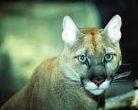
The study has taken into account five key variables: the number of endemism and the endemic species/surface relationship, both in plants and vertebrates, and habitat loss. These factors do not have the same value, so they cannot be classified only quantitatively. For the purposes of qualitative comparison, a relationship of the eight hottest biodiversity points has been developed (Table 3). The spaces, for their explanation, must be three times divided into ten cousins per variable. The first are Madagascar, the Philippines and Sundaland, which in all variables appear among the first ten, followed by the Atlantic forest of Brazil and the Caribbean. Three of them, Madagascar, Philippine and the Caribbean, have little surface and their importance increases.
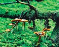
Two other hot areas, the tropical Andes and the Mediterranean Basin, in terms of their conservation, are candidates to be super-hot areas considering the extraordinary presence of their endemic plants: 20,000 and 13,000 respectively. The tropical Andes occupy the first place in endemic vertebrates and the Mediterranean basin ranks third in endemic plants, with 34% more than the fourth. In short, the remaining habitats in the 25 hot areas, that is, 1.4% of the dry land, house 44% of the terrestrial vascular plant species and 35.25% of the vertebrate species, with risk of extinction. In many of these areas the proportion of endemic vertebrates would be easily measurable. It is often considered good that if the current mass extinctions remain poorly studied, in the short term a third or two of the species would disappear. The analysis of hot areas indicates that the problem would be largely solved by protecting these 25 hot areas.
Buletina
Bidali zure helbide elektronikoa eta jaso asteroko buletina zure sarrera-ontzian


