


UTM, king of modern geography
"Do not waste time with latitude and longitude." This tip is heard among users of GPS devices. Latitude and longitude is a classic method to determine a point of the terrestrial surface, which is very included in our culture. But it is not the only one and not always the most useful.
For example, calculations made by geographic-related electronic devices are simplified instead of using grades, minutes, and seconds, using simple Cartesian coordinates. Therefore, although longitude and latitude have not disappeared (and probably do not disappear), other coordinate systems are becoming more common. Currently, UTM is the most common.
Latitude and longitude are values of two angles and the UTM coordinates are distances. For example, in latitude and longitude, the position of San Sebastián is 43° 19' 15" N and 1° 59' 04" W, while in UTM coordinates the position of San Sebastian is 30T 582347 m E 4796937 m N. The numbers seem more complex, but being the meters, they are easier to handle than the angles. The distance from San Sebastian to Bilbao, for example, is an angle calculated in the traditional system (which we later converted into distance), but in the UTM system it is calculated directly in meters.
However, it is no coincidence that the old system has been maintained. It has many advantages. The latitude of a point gives an idea of the distance to the poles. Given this information in meters, it is a too large number to understand it intuitively, somehow it is easier to use the angle. In addition, this concept is very rooted and has been used for centuries by browsers, for example.
Mercator and UTM
Along with the latitude and longitude system, the navigators have used the Mercator projection on the maps. There are many other possibilities of projection, since the terrestrial surface is a three-dimensional body and there are many ways of representing it in two dimensions. Projections are due to the need to project the land surface to perform any map. There is no perfect projection. To represent well a characteristic of the terrestrial surface, others are deformed. The projection of Mercator represents well the distances and the angles; it is ideal to represent routes. That is why he triumphed in navigation.
This success has remained to date, not replacing the projection of Mercator. However, as technology advances, we have been improving. And that is the projection of the UTM system: Improved projection Mercator. The term UTM means Universal Transverse Mercator, the indirect Universal Mercator.
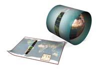
Both, Mercator and UTM, are cylindrical projections; the maps are drawn as if they had placed the paper around the Earth; as if a whole circumference of the earth's surface was touched. The difference is in the circumferences that each projection uses.
The Mercator projection touches the terrestrial equator. Therefore, the equator is represented exactly, without any deformation. From there to the north and south, deformation increases exponentially.
The UTM projection is indirect, that is, it uses meridians. And not a single meridian, it uses 60 meridians (and is actually a set of 60 projections instead of a single). In fact, the land surface is divided into 60 zones (a distribution similar to that of time zones). Each zone has a width of 6 degrees, which in the equator is 668 kilometers and is narrowing as it approaches the pole. The exact representation of each projection is the central meridian that is exponentially deformed towards the east and the west, but being divided into 60 projections, this deformation is very small at the ends of the zones.
Apparently complex complex
The fields are numbered from 1 to 60. And each field is divided into twenty parts, each of them represented by a letter. The entire Basque Country, for example, is located in part 30T (specifically, the limit of zone 30 is the Greenwich meridian). The coordinates of Donostia are 30T 582347 m E 4796937 m N. First the zone 30T is indicated and then there are two distances: the one that is for the central meridian of the field and the one that is for the equator (both in meters), that replace respectively the longitude and the latitude.
It is not an intuitive coordinate system. It is more useful to perform calculations, but it is not intuitive. And it has "rare" characteristics. On the one hand, it does not represent the entire terrestrial surface, the poles are not found in the UTM system, reaching up to 84 parallels north and 80 south. The reason is that in the polar territories the deformation in north-south direction increases to infinity. For the representation of these territories UPS coordinates ( Universal Polar Stereographic ) are used. On the other hand, in the southern hemisphere, the zero of the second coordinate of the UTM is not in the equator, but in the parallel to the south, thus avoiding the use of negative coordinates. In addition, it has some exceptions: The 32V table is extended to include all Western Norway and the 31X-37X north sections are also extended to introduce the Svalbard archipelago.
However, the UTM system standard has advanced. It does not replace the "personal" use of latitude and longitude, but according to experts, if you buy a GPS device it is better to adapt to the UTM coordinates. The option is yours.
Buletina
Bidali zure helbide elektronikoa eta jaso asteroko buletina zure sarrera-ontzian


