

Greece on fire
2007/08/30 Rementeria Argote, Nagore - Elhuyar Zientziaren Komunikazioa
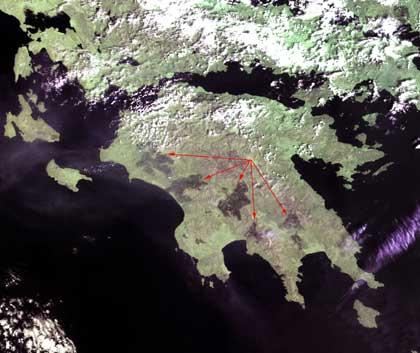
Today, the fires of the Greek peninsula of Peloponnese are spreading. The disaster is spectacular and more evident if you observe the photographs taken by satellite. ESA sources have noted that this year in Greece there have been more fires in the last decade than in the rest of Europe.
Greek fires have been recorded via satellite at ESA. Two satellites (ERS-2 and Envisat) continuously track fires on Earth. In satellites there are special sensors that remotely measure the temperature of the earth's surface and indicate if there is a fire in a certain place at temperatures above 35ºC during the night.
The data obtained by the satellites produces a global fire map, called ATSR World Fire Atlas. And they are made available to those who need data for research (atmospheric chemistry, global warming), fire prevention, meteorology and everything necessary.
Photo: ESA.

Gai honi buruzko eduki gehiago
Elhuyarrek garatutako teknologia