The Valley of Death, desolation zone
Death Valley
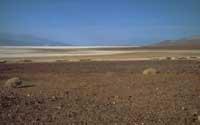
The image that comes to mind when listening to the Valley of Death is one of those that have often taught us in the western: at the height of whitish cow skins semi-buried in the calcined sands of the desert, the lost carriage is difficult to advance, and in the ravine one of the areas of skins, the calves of the musuzuris
are prepared for the first occasion. The image is not very satisfactory, but good. Death Valley was a terrible obstacle in the 1849 Golden Burst, when thirty miners sought a shorter road to California, for which only eighteen arrived. The name of the territory, Death Valley, comes from that event, although it seems that only a miner dies.
The Death Valley is located southeast of California, on the border with Nevada. In fact, Great Basin Desert is a part of an extensive territory, bringing Nevada, Utah, Arizona, New Mexico and some peculiarities of the southeastern California desert, where the plants and animals of the Death Valley are ecologically representative of the Mojave desert. However, the Death Valley is unique in many parts, as it is the lowest, warmest and driest place in North America. To natural beauty we must add scientific interest, as we will see.
Currently, the Death Valley National Park has 13.500 km 2, that is, more of Navarre and Alava at the same time, of which 1.400 km 2 are under sea level. It is the largest national park in the United States, apart from Alaska, which is close to a million visitors a year.
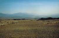
The Death Valley has a width of between 6 and 26 km and a length of 225 km, surrounded by desolate mountains and bright colors, originally volcanic. The Panamint mountain range, located to the west, does not allow the passage of the humid winds of the Pacific, with a maximum height on Mount Telescope of
3,367 m. To the east of the valley is the Sierra de Amargosa, from which part the Amargosa stream, which remains almost always dry, like the rest of the channels of the valley.
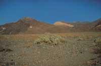
The summer temperature usually exceeds 50ºC in shade and in 1913 the Weather Service recorded 56.7ºC, the highest temperature in all the United States. On the other hand, the average annual rainfall
is 3.8 cm 3 in areas below sea level and 38 cm 3 in the highest mountains in the area.
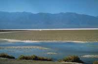
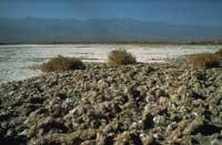
The lower part of the valley is mostly covered by salt fields, totally vegetated and surrounded by salt water wells. Above, sand and salt are sometimes mixed into dunes. Although it is impossible today, the Death Valley has been flooded in the past. For example, 2,000 years ago the valley was covered by a lake nine meters deep, and in the Pleistocene Wisconsin glaciation, 10,000 years ago, the depth of the lake was almost 200 m. The evaporation of this lake has resulted in both the extensive salt fields mentioned above and other geological structures such as fossil beaches.
As for the development of the National Park, some historical landmarks can be noted. President Hoover declared it a national monument in 1933, protecting 7,082 km 2. Later, in 1937 President Roosevelt added to the monument the Nevada area, adding 1,214 km 2 more. For his part, President Truman declared in 1952 the 16 hectares of Devil's Hole as part of the monument, although far and away from the main core, in
order to preserve his scarce endemic fish Cyprinodon diabolis. It was approved by the United Nations as a Biosphere Reserve in 1984. Finally, in 1994 President Clinton incorporated 5,261 km 2 more, assigning the monument the category of national park. It is evident that on this surface there are fascinating visions of the desert, rare living beings, complex geology, intact nature and places of historical interest.
Endemic desert fish
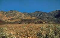
In most cases, the valley floor stands out from the heat. The sky is intense blue and the air is very transparent, so that the far reaches the eye. During six months of the year, the cupidized heat calcins the Death Valley and in the other half of the year the heat attack is slightly softened. The rain is very difficult to overcome the western mountains, but the few drops of water that arrive give life to The Valley of Death and they do it suddenly.
Despite the austerity and austerity of the environment, more than a thousand species of plants inhabit the enclosure of the National Park of La Muerte, being some sixty endemic to the euro. Of course, the inhabitants of the deepest areas of the valley are adapted to the desert conditions. In some cases, the roots are buried deeply, ten times the length of a man. On other occasions they have a radical system that does not deepen but extends to all parts. In most cases, these
plants will have a solid surface that minimizes sweat evaporation. However, there is a gradation ranging from the microscopic plants of the salt fields to the junipers and pines of the summits.
At the same time, various species of animals have adapted to live at the "end", which has been an advantage. All the animals in the area are at night to avoid the most incandescent heat, so they are hardly seen in daylight. Limited to vertebrates, and taking into account observations from 1933, six species of fish, five amphibian species, 36 reptile species and 51 mammal species have been listed, while more than 200 bird species move through the Death Valley, but only a few inhabitants.

Among them is the presence of six species of fish in the driest and salty desert. Moreover, knowing that five euros are endemic. However, the explanation of this inexplicable phenomenon has been found in the aforementioned geological history. As the old large lagoon evaporates, the remaining water surfaces are saline remnants of the original habitat. The evaporation of the lake caused the species to be destroyed or isolated in isolated wells. Zenuk adapted and evolved creating new subspecies and species. Each of them lives in a reduced and reduced environment, and their scarce populations are in persistent danger. This is the case of the small fishes of the genus Cyprinodon or, for example, of the water children Assimnea. Therefore, we can say that they are relics of the Ice Age.
It is clear that living beings are not lacking in the Valley of Death, even though their name suggests something else, or that our eyes perceive nothing.
Death Valley Shoshones
Over the centuries, the Timbisha people of the Shoshone tribe have been the only one who has dared to live in the Death Valley, and these Indians shared the suffocating heat of summer in the high mountains. They are currently without territory and about to be destroyed.
However, from 1933, when Death Valley National Monument was declared, the Timbisarres were subjected to a territory of
16 hectares in India, specifically Village. There live 50 people, mainly washing the clothes of their guards or selling baskets to tourists. In total there
are 300, but they cannot be kept in that cylindrical enclosure of the park, since there is no possibility of modern life and traditional life, that is, collection and hunting, which are prohibited.
Timbisgers and the National Park Service have long been questioned. The Indians have requested within the park a reserve of 3,000 km 2, thus recovering their hunting
grounds, burial areas, hidden springs and sacred corners of spiritual meaning. On the contrary, the National Park Service has offered them 44 km 2, divided into three sections and outside the territory of the park.
The issue is as complicated as Clinton's, but it seems to be resolved this year. Throughout all this, the possibility has been extended that the internet and, as in the rest of the parks, the Indians will soon leave the park. Simplifying a lot there are two reasons for this. On the one hand, they say that the management of a park without wild humans is much easier than that of the human being, since the ‘savages’ are a constant source of problems. Second, and as the evil mictions say, in the higher spheres the tymbisagras have not been forgiven, with the aim of stopping the illegalization of Canyon Resources Briggs Corporation in the Panamint area against the plan of exploitation of red gold.
In fact, this corporation is building a huge open gold mine, just two miles outside the park boundary and in the Timbishares' goose territory. The gold release of the mine will be done by cyanides, using the method called cyanidation. Thus, to extract 600,000 ounces of red gold expected over the next eight years, in addition to the water supply problem needed for the process, tons of cyanide residues will accumulate in the millions environment, along with the risk that this deadly poison will expand anywhere, as happened recently on the Blackfoot
River in Montana. Greenpeace has also opposed the project.
Despite not knowing the resolution of the dispute, there is a first couple of comments in view of the position of the National Park Service. First of all, this issue has upset all the good image of the National Park Service, which has often been identified with Yogi, Boo-boo and forest rangers. And it has also touched the Clinton administration itself, although it has not reached the measure of Monica Lewinsky, of course. On the other hand, and considering cultural conservation, it is very ironic to see to what extent this Service shows a lack of concern about the importance of the relationship between a tribe and its territory. Very ironic, considering that the National Park Service aims to ensure the conservation of U.S. values.
Another reason to hope that the resolution will be contrary to the Timbisians is that of jurisprudence, since there are several tribes pending the judgment. If it were favorable, there is a tribe of the national park that claims rights over its territory. They are expectant, for example, to relocate the Hualapai Indians to the Grand Canyon of the Colorado River, or to reintroduce the village of Navajo at Canyon De Chelly, or to hunt the Idaho shoshones at Yellowstone, or the Montana blacks at Glacier National Park. There are dozens, that is, too many to open the tap in the Death Valley.
Makeshift cities and ghost cities
Mining in the Death Valley, after the California Golden Slope, reached the top since 1849. Gold, silver, copper, lead and borax are some of the most notable findings. In the beginning, the exploitation of these quails was once and for all, especially because of the lack of effective technology, the scarcity of water and fuels and the difficulty of transport.
However, these first steps of departure were sufficient to demoralize the traditional life of the local shoshones timbisenses, since on the one hand the miners appropriated the springs, and on the other, the pines of the mountains were thrown to supply wood, and the Indians were left without pine nuts to eat.
However, since 1900 special attention was paid to the exploitation of red gold and white gold, which resulted in large-scale operations. In fact, boom towns were formed around important mining sites and soon after, for three or four years, they disappeared immediately, as it emerged, leaving the entire territory hanging from ghost towns.
Here are some of the following and others found in California and Nevada: Ballarat, Chloride City, Greenwater, Harrisburg, Leadfield, Panamint City, Rhyolite, Skidoo...
The most important was Rhyolite, which at the time culminated with 10,000 inhabitants, becoming the largest city of the Nevada era. The Urban Queen of the Death Valley. To sum up, the question was: Shorty Harris discovered red gold in 1904 and the city grew suddenly, with two churches and 50 halls between 1905 and 1911, hotels, shops, school for 250 children, eight doctors, two dentists, an opera, a fridge... Electricity reached Rhyolite in 1907, but also financial fear, and from there the city went down until in 1911 closed the most important mine. Finally, in 1916 electricity was cut, leaving the current city inhabited by ghosts.
When Ibarra was assigned the category of national monument in 1933, mining was paralyzed, but soon resumed. Since then, activity within the park has been regulated at most and has been reduced, or the limits have been adjusted to keep mines out of the park, but there has not yet been a total ban. It is something that attracts attention: a friend cannot have a granite of stone, while a corporation can exploit tons.
Death Valley Basque
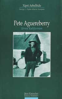
That Basque was not originally from Eibar, but from the suletino of Onizepia. His name was Jean Pierre Aguerreberry, founded in 1874, and at fifteen he got his father's permission to go overseas to his older brother Arnaud, after long dreaming of old vineyards, orchards, farms, ranches and beautiful gold mines of California.
A similar dream was held by many Basques, to the point that, in Los Angeles, there were other Basques to begin publishing a priest. In fact, in that city appeared Escualdun Gazeta in 1885, "lehemisiko escualdun gazeta del mundo", as can be read in the presentation of the number of the stranger.
He arrived in San Francisco in 1890 and seven years
later Jean Pierre Aguerreberry obtained American papers. He worked in various trades throughout California and Nevada: first pelotari, then pastor, farmer, winemaker, milk songbook, post office, water scraper and, finally, gold
picker. Meanwhile, he waged a hard struggle to learn English. His friends knew him of solitary pete or French pete before. The surname also received a small change, becoming Aguereberry.
As already indicated, it finally became a gold seeker and
both gold. Pete's life began in 1902 in the small village of Goldfield in Nevada. Later he went to Rhyolite to the perfection of 1905, in the childhood of this ghost town, but he did not stop for a long time. In the following June he left the Rhyolite and tried to cross the Death Valley from east to west with his donkeys, but in the program he died almost with thirst and solar
zinc. However, a month later, coinciding with the Shorty Harris, Ballarat heads towards the sudden city, exploring a
very good looking hillside and even discovering red gold.
By August there were already twenty groups looking for gold around. In the camp there were about 300 people, who later became known as Harrisburg. In the beginning Shorty and Pete thought of naming Harrisberry, but apparently Shorty modified the story of the discovery.
Anyway, Pete got north of the hill, where he dug the Eureka mine. He worked as a miner in the next twenty years until he found himself insane in 1930. Although lately his nephew helped a little, the Eureka mine was excavated and exploited exclusively by Pete. He lived in an annexed booth for almost forty years. Subsequently, this site has become an important element for the hibernation of the scarce Townsend earling bat ("Plecotus townsendii").
After many anecdotes that follow in western films, Pete Aguereberry died in 1945, unpublished, and is buried in Lone Pin, California. However, the memory of Pete remains alive, as in the surroundings of the Eureka mine there is a viewpoint with one of the most beautiful views of the Death Valley, the so-called Aguereberry Point on the maps, as has Pete himself.
Buletina
Bidali zure helbide elektronikoa eta jaso asteroko buletina zure sarrera-ontzian


