Jaizkibel-Ulia: protection pending exit
The term lack is repeated again and again by scientists investigating the Basque seas. And that lack is the lack of official support. The Eastern Cantabrian is a very rich area from the point of view of biodiversity and biology in general, and is not protected.
Therefore, OCEANA, an international organization dedicated to the protection of the seas, and the Official College of Biologists of the Basque Country (DOUE) are proposing the creation of an ecological corridor. With this name, they would form an ecological corridor protected on the coast of Donostia-San Sebastián to Biarritz, integrating it into the Natura 2000 network.
"In fact, an ecological corridor is a corridor, a kind of corridor, but in this case it is an ecological corridor for the living", says Enara Markos, biologist of the Basque Association of Izurde and Baleen, one of the experts in the study of the corridor proposal. "That is the meaning of the word. I would unite a protected area with another". And in those territories where there is no protected area, the concept of corridor can also have a geographical expansion objective of official protection.
Coastal corridor
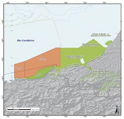
OCEANA and the DOUE propose a corridor that covers the maritime area located opposite the coast of Donostia-San Sebastian to Biarritz. Since the sea of Laburdi is already protected, the maritime area located opposite Jaizkibel and Ulia should be protected, and the well formed corridor would occupy a total of 37,000 hectares of surface.
"However, this is nothing more than a proposal; it is up to public institutions to do more studies and adapt the proposed area," says EBEO Dean Jon Ander Etxebarria. Adaptation can be based on the work of scientists. "To the South we have AZTI and to the North IFREMER. They can benefit from the work of these marine research centers."
They want the corridor to have 5 or 6 wide nautical miles, approximately 9 kilometers. In principle, states have competence in a range of up to 12 miles, but this proposal covers a smaller scope. The reason is to be consistent with the protected area until Lapurdi. The marine protected area that reaches Hendaia is 5 wide marine miles and biological coherence demands to protect an area of the same width. The proposal is to expand the protected space in Iparralde.
In the area of Lapurdi a lot has been worked in the protection of the sea, especially in the last three years. Seven marine areas have already been protected. On the one hand, there are two areas of Special Protection for Birds: Bay of Hondarribia and reefs of Biarritz. And five other protected areas on the coast of Lapurdi: Txingudi Bay, cliffs of Abadia-Lohitzune, estuary of the Urdazuri River, cliffs of Lohitzune to Biarritz and an expansive area to the open sea. Together all these spaces, the entire coast of Lapurdi is protected and integrated in the Natura 2000 Network.
The objective of the Natura 2000 Network was the creation of ecological corridors. It was created by the European Union on 21 May 1992 through the Natural Habitats Directive. It details the characteristics and requirements that a natural space must fulfill for inclusion in the Natura 2000 Network. And since its entry into force they began to be called corridors between already protected areas. But not at the same speed everywhere. The Natura 2000 Network is rapidly developing for land areas, but with maritime areas it is much slower.
"Now the European Union is doing a lot of strength to form a network at sea," says Marcos. "In France, protected spaces have already been created in the sea, as well as steps that unite them, but in Spain there is still a great void. Hence the proposal comes now, on the one hand is a proposal to create a protected marine space and, on the other, it aims to integrate it into this Natura 2000 network."
However, the European Atlantic coast is largely constituted. From the Baltic, protected to Hendaia, there is a large gap in the Iberian Peninsula. That is the lack to which the experts refer. And realizing this lack, the idea of the corridor's proposal arises.
Origin of origin Origin
From different places came a response to the lack. On the one hand, the Basque Government through AZTI began to analyze a solution. They began to take a few steps. In the Autonomous Community of the Basque Country there were 52 land areas integrated in the network and none in the sea. Therefore, the objective of the study was to determine what type of marine areas could be called in the eastern Cantabrian.
On the other hand, the OCEANA organization also appropriated the peninsular deficiency and monitored the sea from A Coru to Hondarribia in 2008, with the help of the Ministry of Environment.
The sum of the analyses and strengths resulted in a large number of proposals, which include an area in Gij nen, another three in Galicia and others in Cantabria.
In the Basque Country, an option was the coast of Jaizkibel and Ulía, that of Getaria and that of Ogo or zone (in Txingudi) and the canyon of Capbreton. They were not the only options, in total 15 zones were analyzed, but those four remained.
"This is not closed," says Etxebarria, dean of the EBEO. "In open sea, whether cetaceans, pelagic species or highly threatened habitats located one thousand or two thousand meters from the sea bottom, many other areas will need to be protected. Now we have strength in Jaizkibel-Ulia, but of course little by little we will have to propose to others."
Once the decision was taken, they began to work. Two institutions, OCEANA and DOUE, have led the proposal, but in one way or another many other organizations and groups of scientists have worked. For the definition of the project data were collected from numerous marine investigations.
On the one hand, for this proposal the data of the investigations carried out by the official organisms AZTI and IFREMER have been used. On the other hand, there are numerous specialized entities that have made contributions in their respective fields. The Gipuzkoan organization INSUB has investigated the marine background, mainly invertebrates and algae. The association EIBE Euskal Izurde eta Baleen has given data on the populations of cetaceans. The Spanish Institute of Oceanography has also carried out research. Therefore, OCEANA and the DOUE have compiled data on research carried out during years in the Basque Sea.
The criterion has been the analysis of the parameters of biodiversity, considering geology, sedimentation and coastal dynamics, physical-chemical variables, climatology, etc., where specific biological conditions are observed. "For this reason, the existing level of biodiversity allows being one of the main maritime corridors at European level," explains Etxebarria. "The area of Jaizkibel-Ulia is much richer than that of Deba-Zumaia or Lapurdi."
In addition, since 2008, specific studies have been carried out for the proposal, through underwater robots and divers, to confirm the presence of different species, carrying out the last investigations in summer of 2010. There has also been a great bibliographic search that has gathered in a single document the information already dispersed. In this way, they have elaborated as much scientific information as possible to support the proposal.
One of the causes is the geology of the area, formed by sandstones with erosion and special sedimentation. The presence of unique ecological niches, as well as eroded paleocanals have led to numerous biotopes such as underwater caves.
"This implies a greater development of algae than in other zones, giving rise to biological conditions; greater development of invertebrates and phytoplankton, greater presence of pelagic fish, more cetaceans and more birds," says Etxebarria. "To this we must add that, being next to Txingudi, all the marine birds of the Palaeartic pass by here, that is, those of North Eurasia and Africa." Hence, the area of Jaizkibel-Ulia is a point of concentration of biodiversity.
The proposal, in principle, is proposed as an extension of the protected areas on land; the Ulia and Jaizkibel mountains are protected by a LIC. "That has a biological logic," says Marcos. "It seems that the aquatic and terrestrial zones are divided, but they are very related. The biological processes that occur in one of them directly influence the other".
Administrative procedure
The study prior to the presentation of the proposal has been carried out, the data have been collected, the corridor area has been defined and now the proposal is in the administration.
The competition is in Madrid, in the Ministry of Environment. By administrative or political deference, it has been developed jointly with the Basque Government, jointly presenting the project.
It is not the only case. For example, the earthly Nature 2000 (Bardenas, Bértiz, Urbasa or Gorbeia) has been presented together with the Basque Government, which brings it to the Ministry and subsequently presents it jointly in Brussels. But its own administrative competence corresponds to the States, that is, to the Spanish Ministry of Environment. Even more in the sea, maritime competences are of a state scope.
While the corridor proposal is doing the administrative way, "we have not stopped," says Etxebarria. "We are working in Brussels, Madrid and Vitoria. Also through OCEANA, in OSPA (with members of the Oslo-Paris agreement that manages the north-eastern Atlantic). Strategically, now is the most important time for the Master Plan of the Pasaia Outer Dock, but we are also working on the administrative path of the proposal. At this time we are also holding meetings with the administrative authorities and agents of Lapurdi to make known the proposal."
Exterior port of Pasaia
Do not forget one of the biggest problems that must overcome the corridor proposal: Proposal of the outer port of Pasaia.
"If they made an outer port, our proposal would be sidelined and would not make sense," says Etxebarria. For them, the ecological corridor is incompatible with the outer port. Etxebarria gives strength to this word. "In our claims we use the concept of incompatibility. Based on biological, legal and procedural reasoning, our conclusion is that there is incompatibility between both."
All the entities that have worked in the proposal of the corridor have presented at the beginning of December allegations to the plan of the port. "We (DOUE) have just submitted allegations. OCEANA also. And EIBE and other associations, political groups, unions, ecologists, mountaineers, etc. Our scope is science, but as it is a threat to our scientific proposal [outer port] we have presented this proposal, our allegations and our alternative," says Etxebarria.
The claim requests that corrective measures be adopted for emissions to the atmosphere, dust, discharges, vibrations, traffic, etc. Based on the environment.
OCEANA, EBEO and other institutions are waiting for it. The allegations must be answered. Subsequently, they must prepare an environmental report with the responses to the allegations, as ordered by the Ministry of Environment and with the contributions of the Ministry of Public Works. Subsequently, the Ministry of the Environment will prepare an environmental impact statement called DIAS. With this assessment will be decided whether or not the project of Puerto Exterior of Pasaia will be addressed. "There the yes or no will be resolved," says Etxebarria.
This will open or close the way to the corridor and, for the moment, to the development of the Natura 2000 Network on the Gipuzkoa coast.
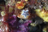
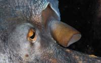
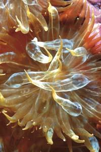
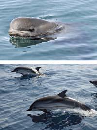
The photographs of this article, except those of cetaceans, are images obtained during shipwrecks made by OCEANA. We have published them with your permission to illustrate this article.
Buletina
Bidali zure helbide elektronikoa eta jaso asteroko buletina zure sarrera-ontzian


