Weather map
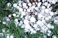
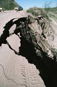
Water and summer, in addition to the dictionary, have been together in the last two months. If before there was little talk of time, this summer, on an earlier occasion a colleague said that Euskal Herria has become a great elevator; only time has been spoken of. On the one hand, because it has been the rainiest summer of the past and, on the other, in Central Europe, first in Euskal Herria and then in Asia, because the rains have left unusual images.

Therefore, it has been a great blur or storm the word that time advertisers have repeated over and over again this summer. But what is a hard storm? And the anticyclone? How are weather predictions made?
Observation is the basis
Meteorology is a science based on observation. Weather predictions therefore require a long time looking to the sky. You have to look at the direction and strength of the wind, the abundance and shape of the clouds, the temperature, etc.
Professional meteorologists, throughout the day, repeatedly measure atmospheric pressure, temperature, humidity, wind strength and direction, precipitation and solar radiation, among others. This work is done in weather stations around the world.
This data, first of all, is collected and analyzed in national institutes and hence referred to regional meteorologists. They perform prediction models and include data in synoptic maps.
The synoptic map or weather map is a map that summarizes the explanations of weather forecast on television. It is used daily in the centers of analysis and prediction and just a look to know the direction and strength of the wind to locate the fronts of bad weather and the areas of low and high pressure. This defines the great traces of the time it will make in the region.
Isobarous maps
The isobaric map is usually the second map of the weather forecast. There, the atmospheric pressures measured in the weather stations are written and the points of equal pressure are joined by a line, as the relief is depicted in topographic maps.
The lines of isobaras are therefore lines that bind points of equal pressure. Bar is called the pressure measurement unit from which the name is derived.
These maps, with some custom, are a useful source of information. Depending on the pressure, low or high cloud zones and wind force are also defined. Thus, in low pressure areas strong storms are drawn and in high pressure cyclones.
Anticyclones are closed air cores that rotate in the same direction as clockwise. Inside the anticyclone air descends, compresses and evaporates moisture. Therefore, in the area of the anticyclone there is no fog.
In low-pressure areas, below 1013 millibar, cyclones or hard storms are drawn. The isobarous maps are represented with the letter B. In these areas of depression, unlike anticyclones, the air rotates counterclockwise and ascends to cooler areas. This cools the air and clouds form. Cyclones move from west to east.

In addition to serving for the location of cyclones and anticyclones, depending on the distance between the lines of isobaras, meteorologists define the wind force. The smaller the distance between the isobarous lines, the higher the pressure gradient and the greater the wind force. Generally, low pressure zones are the areas with the greatest wind force. And if the cyclone or depression is in the ocean, meteorologists will not have too many doubts to predict large waves.
Few clouds, but cold or hot?
After information on fog, only temperature variations are determined. To do this, it is ideal to make an isothermal map, that is, instead of drawing lines of isobaras, draw a line that joins points to the same temperature.
However, we must know that the closest atmosphere to the ground is divided into homogeneous air masses. These air masses are huge volumes of air thousands of kilometers long without large variations in temperature and humidity. They occur on oceans and continents and can be hot, cold, humid or dry.
But what does the time preacher say when he says the cold front is approaching? The front is the limit between two air masses of very different characteristics. That is, the area where the hot and cold air mass is crossed. When air masses of different characteristics find their way, they push each other and move to areas of different pressure and temperature.
The cold front arises when a mass of cold air meets a heat and passes under. The denser, cold air mass abruptly drives the hot air mass from bottom to top. The rise of air masses produces vertical development mists and rains intensively. The strong cold southwest wind and the black clouds of the west and northwest announce the cold front.
The warm front occurs when the hot air mass passes over the cold. This time, the hot air mass is the one that presses on the cold. Until the arrival of the front, the wind blows southeast and east and the rainfall it produces is weaker.
Knowing all this, what time do you forecast for tomorrow?
Published in 7K.
Buletina
Bidali zure helbide elektronikoa eta jaso asteroko buletina zure sarrera-ontzian